skip to main |
skip to sidebar
Bunaken Marine Reserve, Sulawesi, Indonesia: Saturday, 7th February 2015
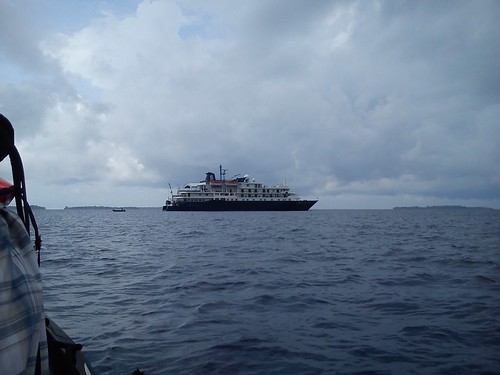
Arriving by sea
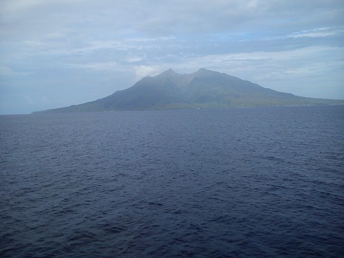
After a leisurely overnight cruise from Bitung, ‘Caledonian Sky’ arrived off Bunaken Island around 8.00 a.m. where she held station ‘adrift’. Bunaken Island lies at the north eastern tip of Sulawesi, but on the western side of the promontory. Looking towards the mainland, we could see the city of Manado. By road, we could have travelled from Bitung to Manado City in a little over an hour!
Exploring the Marine Reserve
The Marine Reserve at Bunaken is one of the most important sites in the world. There's a little about the area on the Official Indonesian Tourist Site here and on Wikipedia here.
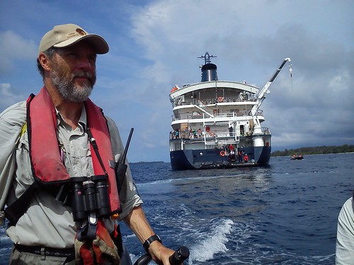
On our arrival, members of the expedition team left the ship by Zodiac to scout a suitable area for snorkelling (using a Zodiac as a ‘snorkel platform’) and a separate area for Zodiac Cruises for passengers who were not snorkelling. Surveys complete, Zodiacs took the snorkellers off the ship first and then remaining passengers were divided into groups of ten for the Zodiac Cruise.
 Simon's Zodiac returning to the Marina Deck with a earlier group of passengers.
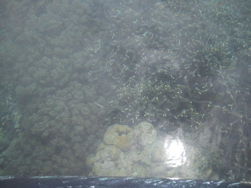
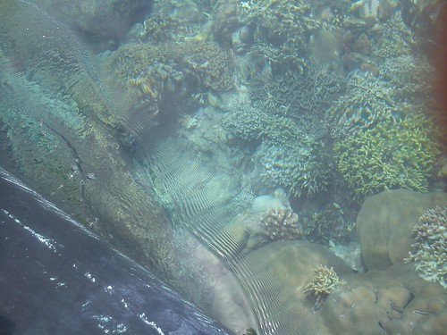
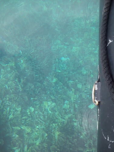
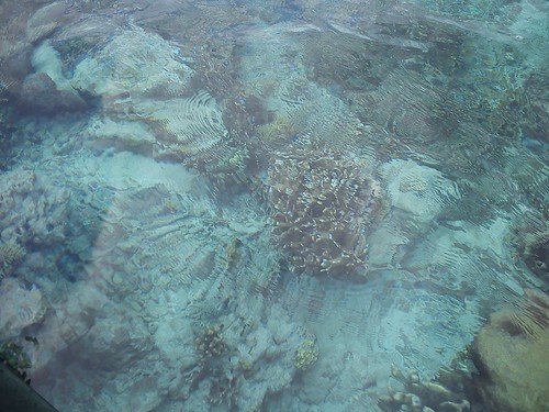
I was in Simon’s Zodiac and, to my delight, we found that coral was remarkably visible even from a Zodiac. With the outboard engine idling, the view was a little distorted by surface ripples but, from time to time, Simon stopped the engine and the views were splendid.
 The world beneath the surface (1).
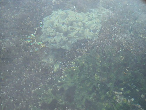
 The world beneath the surface (2).
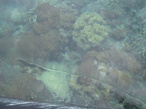
 The world beneath the surface (3).
 The world beneath the surface (4).
 The world beneath the surface (5).
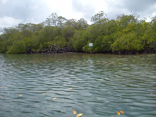
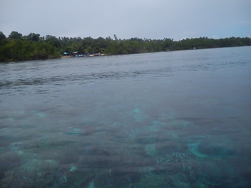 Looking towards Bunaken Island from the Zodiac, with the coral clearly visible in the foreground.
 The world beneath the surface (6).
 The world beneath the surface (7).
We spent a happy hour pootling around over the coral reef. Bunaken is supposed to offer some of the finest snorkelling in the world. Viewed from above the surface, I think the colours are somewhat attenuated but a wonderful impression is obtained of how just varied and prolific the coral is.
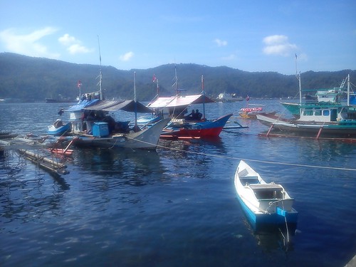
 Most visitors arrive at Bunaken Island (left) by motor boat from Manado at a long pier, just visible extending to the right of the island.
On to Toli Toli
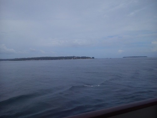
Around 1.00 p.m. we sailed for Toli Toli, our final port call before the end of the cruise in Sandakan. Toli Toli was 266 nautical miles away from Bunaken and we expected to dock around noon the following day, Sunday.
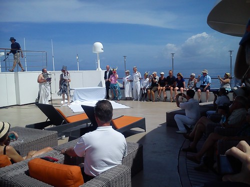
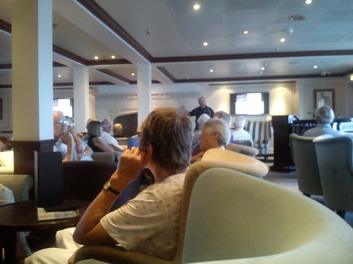 Later in the afternoon, Danny gave a talk in the Lounge.
I’ll describe that visit later but we had an absorbing Sunday afternoon in Toli Toli.
You can find all the posts on this trip here.
My pictures
Bunaken Marine Reserve, Sulawesi.
Sailing to Toli Toli, Sulawesi.
[Scope of text revised, pictures and links added 2-Mar-2015, 5-Mar-2015]
Bitung, Sulawesi, Indonesia: Friday, 6th February 2015
After our delayed departure from Ternate (described in the previous post) 'Caledonian Sky' had sailed overnight towards the improbably-shaped island of Sulawesi, previously called 'Celebes' by the Portuguese explorers. Wikipedia has a brief 'primer' here with an interesting relief map.

Relief Map of Sulawesi (Wikipedia).
Arriving by sea
 Bitung, viwed from 'Caledonian Sky'.
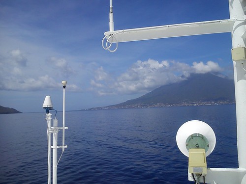
By half past six in the morning, we were approaching Bitung. Bitung lies at the north eastern tip of Sulawesi, on the eastern side of the promontory (see map above). The usual cone-shaped mountain lay in the background, this time with a second collapsed-cone mountain nearer the city. Clearly, Bitung was a location of some significance. Its population (I discovered later) was around 200,000. I believe Bitung became more important as a port after problems occured with silting at the port of Manado. Quays and the associated industries stretched along the shoreline for at least two miles. A Pilot boat delivered the Port Pilot to our ship for the final docking manoeuvres.
 Picking up the Pilot.
As at Ternate, on our way in we passed numerous ships at anchor, some surprisingly large. As we neared the dock, we passed a couple of bulk carriers moored at the quay on our left. One had an electric crane mounted on a gantry on deck to make it self-unloading. Next, we passed a fair-sized passenger ferry, ‘Sabuk Nusantara 51’ with a crane on its foredeck for handling shipping containers. The next berth, opposite a passenger terminal building, was ours and ‘Caledonian Sky’ was gently docked.
Morning: City Tour and Sawangan Village
Outside the passenger terminal, a fleet of air conditioned coaches was waiting for us. First stopping point was only a few minutes away at the Fish Dock. First, there was an area where the nets were being repaired – a task which has been going on for thousands of years. Next, we walked along the quays looking at the large fleet of fishing vessels. The hull profile of these boats seemed quite different from similar craft we’d seen earlier in the trip. The large fleet at Bitung featured sinuous curves and a very high prow. A small wheelhouse was provided near the stern. Usually, there were two or three short masts which supported a fabric roof, tent-fashion, which seemed to provide home for complete families. There was usually a small dinghy on the after-deck – a tiny affair looking more like a child’s perambulator than a boat, with a very high seating position and a fitting at the stern to accept an outboard motor. But, most noticeable on the deck of the main hull, was a rectangular wooden framework supporting two outriggers giving a rather ‘Heath Robinson’ look to the whole affair.
 Small, outrigger fishing vessels at Bitung.
Nearby, one of these ungainly-looking craft was partly sunk with serious damage to the bow. Further along a similar boat had completely sunk in the shallow water and turned onto its side. The wreck was being broken up as watched. Parked at the edge of the quay was a flatbed lorry with a ‘Ferrari 717’ crane together with a high-sided lorry to receive the smaller debris. This was the extent of the automation. Otherwise, there was a cheerful group of men and women working away at the removal process. Most of the men were wearing pale blue polo shirts embroidered ‘OCEANIC FISHING PORT OF BITUNG’. Half of the men were standing chest-deep in the water and wearing face masks, occasionally disappearing underwater to attach a rope or break off some smaller part. One man had a small round net attached to a long pole and he was ‘fishing’ for smaller debris from the quay. Periodically, the group of laughing women would use handbrushes and pans to remove the small pieces that had fallen onto the quay. Fascinated by this good-natured operation, I returned to the bus rather reluctantly as the retrieval crew were using the lorry crane to rip-off a large section of the wheelhouse.
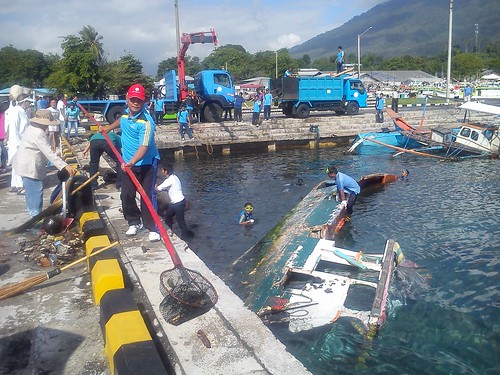 Recovering a wrecked boat.
I hadn’t noticed before that the logo on the side of our coaches read ‘Visit Indonesia – Visit the Land of Smilling People’ (stet). Their English is still much better than my Indonesian. As we left the docks, we passed the fleet of large, steel ocean-going trawlers and saw the separate facility for handling container ships.
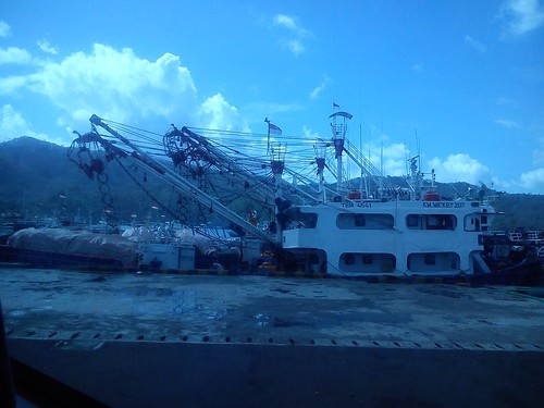 Deep-sea fishing vessels at Bitung.
The roads in Bitung were very busy and it took us some time to reach the local market we were to visit. It took a few minutes for all the buses to find places where they could park off the carriageway without stopping all the traffic whilst we walked through a network of side streets with shops and market stalls on both sides of the road. Large numbers of Honda mopeds slowly pushed their way through the crowds of shoppers. Our arrival created great interest but, as elsewhere, all the people were very friendly.
A glimpse of Bitung Market.
We continued out of the city but speeds did not improve much since there were a few places where the road was flooded. After travelling on smaller roads for a time, we reached our destination, the village of Sawangan. It took a while to manoeuvre our coaches through the gates of the Christian school we’d come to see. A large choir of boys and girls were waiting on the steps of the main building and, conducted by their headmistress, they delighted us with their singing. Afterwards, the passengers distributed ‘goody bags’ provided by the ship to the children.
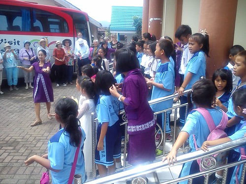 At Sawangan Christian School, the children sang for us.
We then walked through the village to a covered performance area with seats with an ancient water cistern on one side and a ‘graveyard’ on the other. Five musicians in traditional dress played wooden xylophones and later a pretty young woman sang. Then a group of young men and young women dancers performed for us.
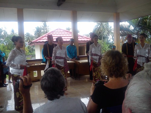 Dancers in traditional dress performing for the passengers.
The large number of ‘Destination Asia’ staff in attendance distributed refreshments to us whilst the dancers changed into modern dress – colourful ballroom dresses for the girls and vaguely ‘Toreador’ style for the boys. After they had danced, they invited passengers to join in the performance. All these activities were keenly watched by a number of local people, especially the children.
We then walked around the ‘graveyard’ where the bodies are placed in Waruga stone sarcophagi standing on the ground, not buried. Here, we were joined by a large number of young people, in jeans and blue polo shirts, apparently part of a tourism initiative. Most of them had mobile phones/cameras and were keen to be photographed with the foreigners and, as always, there was a lot of smiling. By this time, our coaches had moved to a nearby street where we re-boarded for the journey back to Bitung and lunch on the ship.
 The covered performance area viewed from the 'graveyard'.
Afternoon: Tangkoko Nature Reserve
A little after 2.00 p.m. we joined our coaches for our excursion to Tangkoko Nature Reserve (see more about the Reserve here). We were to be taken on a forest trek by the Nature Reserve Rangers with the hope of seeing the rare Spectral Tarsier (Tarsius Tarsier) monkey. We made the usual slow progress out of the city using the road we’d already traversed twice going to and from Sawangan. Then we made a right turn onto a narrow road leading up into the hills. As well as narrow, the road was very twisting and steep, usually climbing but sometimes swooping down again, giving a rather edge-of-seat ride. For most of the journey it was also raining. In general, we were passing through rainforest but, occasionally, plots had been cleared for dwellings or small palm plantations.
 Rainforest with a clearing near the road.
After around an hour, the coaches suddenly stopped. We disembarked and walked to the entrance of the Nature Park. Inside, we were distributed amongst a number of cars and people carriers (all carefully carrying ‘Noble Caledonia’ labels inside the front window) for the journey into the park. This road was unsurfaced, twisting and turning through ancient trees and splashing through flooded sections. It made the coach ride across the hills earlier seem quite tame by comparison. I was quite relieved when we stopped and were able to get out. We’d stopped in a small turning/loading area near a building marked as a Research Station. We could hear the sea nearby but not see it. After a short delay, we were divided into groups of ten, each with a Ranger in the lead and an assistant in the rear, and set off into the forest.
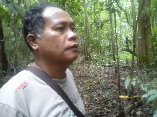 Our Ranger.
The trail was marked with coloured fabric ties on saplings every few yards. We weaved our way uphill amongst the venerable trees up to 200 years old, small roots threatening to trip-up the unwary.
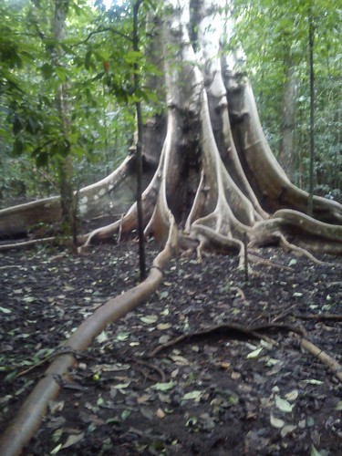
"... amongst the venerable trees up to 200 years old ..."
Our arrival had been timed to be near dusk, because the Tarsius Tarsier monkey we hoped to see is a nocturnal creature and only appears as it becomes dark, to hunt for food – typically insects like grasshoppers. There were a few sightings of other wildlife as we made our way to a massive, old hollow tree known to be occupied by the creature we hoped to see. It seemed a bit unkind to shine lights into the hollow tree, followed by a series of bright camera flashes as everybody tried to secure their own picture, but we all saw one or more of the attractive primates, with their huge eyes staring apparently unconcernedly at the intruders.

My rather inadequate shot of a Spectral Tarsier inside the hollow tree.
.jpg) The same Spectral Tarsier (Photo: Lea McQuillan).
The same Spectral Tarsier (Photo: Lea McQuillan).
We trekked back to the Research Station where snacks and cold drinks had been laid out for us. Some of us walked the few yards to the beach to watch the sea in the gathering gloom.
 The beach adjacent to the Research Station.
The vehicles we’d arrived in had to make more than one round trip to the main gate to return everybody to the coaches, so there was a bit of waiting around. By the time we were all back on the coaches, I was very tired and I slept fitfully as we made our way back along the winding road. Once on the main road back to Bitung, we made better time as the evening traffic was lighter than during the day. Back at the port, I staggered up the gangway of 'Caledonian Sky' and hastily showered. Revived somewhat, I enjoyed an excellent dinner in the restaurant after a very memorable day.
On to Bunaken
A little before 10.00 p.m. we cast off on our overnight journey to Bunaken, just 57 nautical miles away. I’ll tell you a little about our visit to Bunaken next time.
You can find all the posts on this trip here.
My pictures
Arriving at Bitung, Sulawesi.
Bitung, Sulawesi - City Tour & Sawangan Village.
Tangkoko Nature Reserve, Sulawesi.
[Minor revisions, pictures and links added 2-Mar-2015, 3-Mar-2015]
Ternate, Molucca Islands: Thursday, 5th February 2015
Morning: At Sea
We were not due to dock at Ternate until around noon. During Thursday morning we were passing a succession of islands to port, each of which seemed to have its own cone-shaped mountain with a much larger island, Halmahera to starboard.
 Pulau (Island) Makian viewed fron the ship.
 Pulau Makian as shown on the ECDIS (Electronic Chart Display and Information System), in the bottom left of the screen.
At 9.30 a.m. Kathryn gave a presentation entitled ‘Indonesia’s Coastal Sultanates – links between Indonesia and Papua’. The Molucca Islands became important in the sixteenth century when explored by the European mariners, providing Europe with a source of Cloves and Nutmeg, hence the name ‘The Spice Islands’ sometimes used to refer to the Moluccas.
Crossing the Line
Then, just before 11.00 a.m., an imperious voice on the public address summoned all the passengers to the Top Deck. When we were assembled, King Neptune and his court appeared and there was pure pantomime for a while. Apparently, we were ‘Crossing the Line’ and sailing into the northern hemisphere. The Hotel Manager was in attendance and even the Captain put in an appearance. At the end of the slapstick, passengers who had not crossed the equator by ship before were invited to ‘Kiss the Fish’. Fortunately, my sea trip to the Galapagos Islands in 2006 involved 'Crossing the Line' at least twice. There's a rather breathless report on that trip here. After this forfeit had been paid, King Neptune and his entourage returned to their watery underworld.
 King Neptune, his 'Queen' and Courtiers.
There's a history of this curious tradition in the Wikipedia article Line-crossing ceremony.
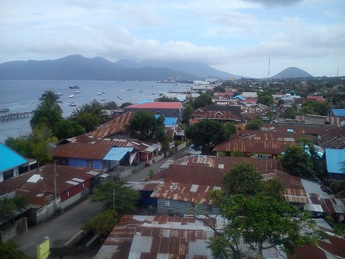
Ternate
 View of Ternate from the Observation Deck of 'Caledonian Sky'.
The port of Ternate was now ahead, with its own volcano, Mount Gamalama, looming over the town. The volcano is active - the eruption in 1840 destroyed most of the buildings and the most recent activity was in 2011. The population of Ternate is currently about 200,00 but I was surprised to see a number of cargo ships anchored in the approaches.
A small ‘PILOT’ launch came out to meet us and the Port Pilot clambered up the rope ladder put out by our crew. The Port Pilot, of course, assists the Captain in bringing the ship safely to the berth.
 Picking Up the Ternate Port Pilot.
 Approaching the jetty at Port Ternate.
We tied-up against a jetty of reinforced concrete carried on concrete piers. I noticed that edges of the concrete dock were crumbling away. We had tied-up opposite a large terminal building with a red-painted corrugated iron roof to which the inscription ‘WELCOME TO PORT TERNATE’ had been added. The gangway had been lowered (after a little delay caused by a mooring bollard being in the way) and, once port formalities had been completed, we were invited to go ashore. Inside the terminal building, a space had been cleared with seats either side for us to watch a different ‘Welcome Dance’ by a group of young men dressed in another traditional costume.
 The 'Welcome Dance' in the terminal building.
We then divided – one group of passengers drove and hiked to see what is reputed to be the ‘Oldest Clove Tree’, whilst I remained with the larger group which elected to take the ‘Ternate City Tour’. Both groups first went, by coach, to the Sultan’s Palace – a large Colonial villa built by the British.
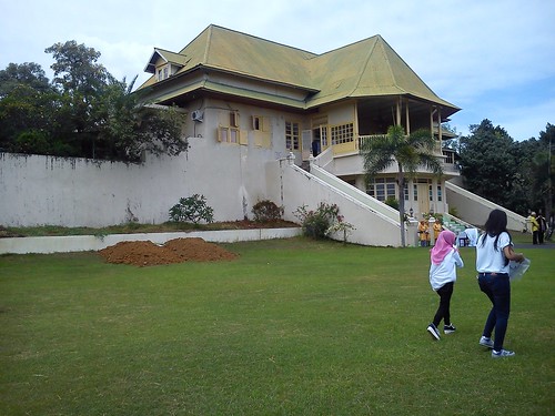 The Sultan's Palace in Ternate.
A traditional welcoming ceremony was held outside before we entered the Palace to shake hands with the frail-looking white-bearded present Sultan before moving through a Receiving Room with a large wooden throne beneath two parasols and an interesting Reception Room to a large, airy room where we were given sweet tea and a variety of cakes, seated on magnificent wooden furniture.
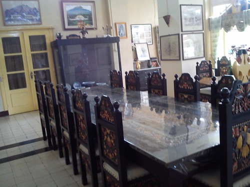 Carved, decorated furniture in the Reception Room.
The faded glory of the place really appealed to me and I was quite sorry to return to the coach, pausing to look into a 2-vehicle garage holding a rather nice four-wheel carriage, complete with carriage lamps.
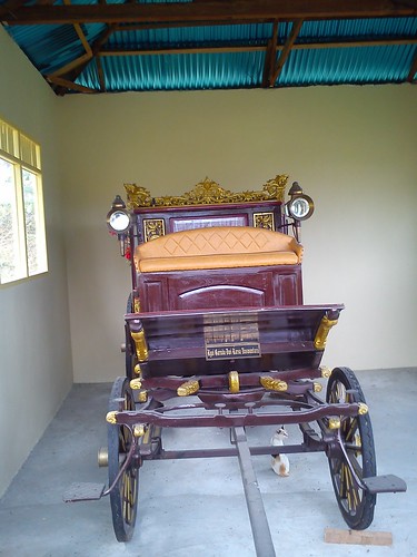
The Sultan's Carriage. When I took the picture, I didn't spot the cat.
We drove in our fleet of coaches just out of town to Batu Angus Kulaba Ternate. This is the lava field left by a previous eruption at the point where the lava entered the sea. The barren ‘moonscape’ of huge, black rocks has been rather imaginatively transformed into a memorial park. Lava has been crushed and graded to provide a series of footpaths made of small-diameter lava stone, lined both sides with edging of larger-diameter lava stone. The footpaths lead to two viewpoints overlooking the sea. A variety of trees have been planted, each set inside a white-painted rectangular frame of concrete. At a number of points around the site, the larger-diameter lava stone has been used to build a sort of hollow ‘cairn’ to serve as litter bins. I found the whole arrangement thoughtful and effective.
 One of the viewpoints in the Memorial Park.
Our coaches took us back towards the town, stopping near Fort Tolucco and creating a traffic jam on the narrow road. Fort Tolucco was originally built by the Portuguese but also used by other nations later. Not very much of the fort remains but it still has commanding views of the sea, the town and, inland, the threatening bulk of Mount Gamalama.
 View from Fort Tolucco, showing the town and the sea.
We made a further stop at the former home of Alfred Russel Wallace (1823 – 1913), generally acknowledged as the co-discoverer, with Charles Darwin, of the Theory of Evolution. Although Wallace became famous in his lifetime, his role has been played-down latterly and he is often depicted as a rival to Darwin. In fact, the two biologists remained friends throughout their lives and Wallace was a pall-bearer at Darwin’s funeral. The house is now a private residence but the lady occupier, who appeared to have a number of children, seemed unfazed by the invasion of a large party of foreigners.
 The bungalow-style Wallace House has broad verandahs front and rear.
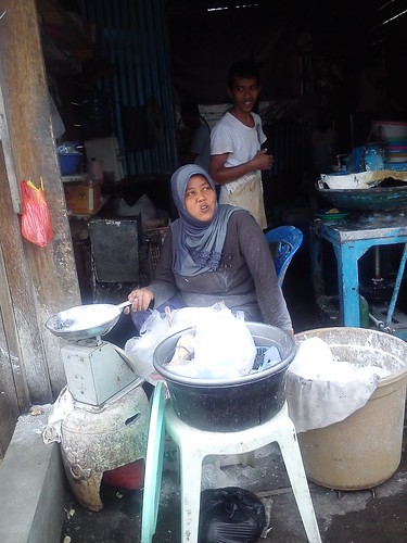
The last stop on our tour was at the market. It seemed to be in three parts: a covered market in a fairly modern building, a cramped area of a number of rows of stalls in between the market building and the road and, finally, long rows of stalls on both sides of the busy road actually in the carriageway, where the stallholders sit on the side of the stall away from the road. Shoppers, or just passers-by, are forced to walk further into the carriageway. With fairly heavy traffic in both directions whilst we were there this is, to say the least, interesting. As always, I was struck by the sheer variety of goods on offer and by the friendliness of the people, who found our presence a huge joke. After an interesting but rather hurried visit, we walked back to our waiting coaches (somehow escaping injury from the passing traffic) and were driven back to our ship after a varied and fascinating tour.
 Ternate Market.
There's an interesting article in Wikipedia called Ternate which includes a decent map which, at larger size, clarifies the bewildering array of islands.
On to Bitung
We were due to depart at 5.00 p.m. on the 154 nautical mile journey to Bitung. However, we had to await clearance from the Port Authorities who, for some reason, delayed our departure. While we waited, one of the inter-island passenger ferries (which also carry shipping containers on the foredeck) arrived and berthed next to us.
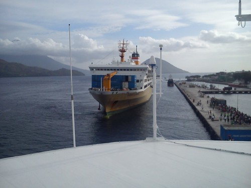 An inter-island ferry berths at Ternate as we await clearance to leave.
We were over two hours late leaving and, we were told later, only received clearance after Destination Asia (Noble Caledonia’s Land Agent) contacted the Mayor of Ternate who intervened with the Port Authorities. To maintain our schedule for the following day, the Captain increased our speed overnight. I’ll tell you a little about our visit to Bitung next time.
You can find all the posts on this trip here.
My pictures
Sailing to the Molucca Isles.
Ternate, Molucca Isles.
[Minor revisions, pictures and links added 27-Feb-2015]
The Boo Archipelago: Wednesday, 4th February 2015
Torobi Island Zodiac Cruise
The ship anchored off Torobi Island at around 8.30 a.m. This was an additional stop which had been inserted into the programme. Originally, we were to land on the beach but it had been decided that snorkellers would enter the water from a ‘Zodiac Platform’ and that non-snorkellers would be offered a Zodiac Nature Cruise, rather than a landing.
 Naturalist and Zodiac Driver Simon Cook in charge of the Nature Cruise. The hydraulic crane at the stern of 'Caledonian Sky' is used to 'launch' and retrieve the Zodiacs.
We made some interesting bird sightings but what particularly impressed me was the views of the wide variety of coral actually visible from the Zodiac. Firstly, the water was exceptionally clear and secondly there was not too much sea movement. The result was that, even viewing from above the surface, impressions of the magical world of the coral reef below could be obtained.
 The world beneath the surface (1).
The world beneath the surface (2).
 The world beneath the surface (3).
We passed one island where sea cucumbers are being grown commercially but we weren’t able to look at the ‘farm’. Apparently, sea cucumbers are regarded as a delicacy by the Japanese.
 A warning sign near the sea cucumber 'farm'.
 Surrounded by islands.
I would have happily remained out on the Zodiac for hours but we had to return to the ship so that it could re-position to the island of Pulau Boo.
 Returning to 'Caledonian Skey' for lunch. There's insufficient room in the 'cradles' at the stern to stow all the Zodiacs so a second hydraulic crane on the starboard side, just astern of the egg-shaped white 'Radome' is used to stow the other Zodiacs on the 'roof'.
Whilst this was going on, the passengers took lunch on the ship, most electing for the open air ‘Lido’ restaurant on Deck 5. Unless there’s bad weather, meals could be taken ‘al fresco’ on Deck 5 or in the air conditioned comfort of the main restaurant on Deck 2, without the necessity of making a prior choice.
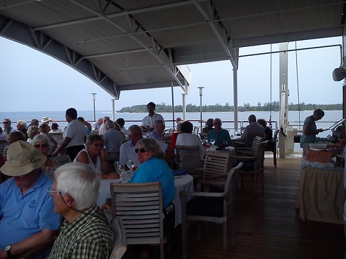 Lunch in the 'Lido' restaurant.
Pulau Boo Landing
Around half past two, the Zodiacs started to ferry people ashore. Separate areas were defined for the Zodiacs, snorkellers and swimmers. Pulau Boo is a small, beautiful ‘Robinson Crusoe’ island, with vegetation (mainly palms) fringed by a narrow, white beach.
 Approaching Pulau Boo in a 'Zodiac'
On landing, I immediately discovered that the white beach is topped with crushed coral, making footwear desirable. Whilst many of the snorkellers and swimmers were still preparing to enter the water, the sea conditions rapidly became more adverse. I was not surprised that I was making slow progress but the Expedition Team realised that more experienced snorkellers and swimmers were finding the situation uncomfortable. At first the “sphere of operations” was made more restrictive but a little later the order went out “Everybody out of the Water” so that only a small number of determined snorkellers were left in the water and a couple of Zodiacs were brought in close as safety boats.
 The beach at Pulau Boo with 'Caledonian Sky' in the background.
With swimming curtailed, I decided to walk around the island and I found a number of other passengers doing the same. The sea views were exceptional. In addition to the crushed coral, there were some fairly hefty lumps of various types of coral littered around. In general, the coral was white but I found a piece delicately lined with blue and another white inside but dark brown on the surface.
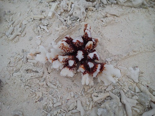 A larger piece of 'brown' coral, surrounded by coral fragments.
A leisurely walk took about twenty minutes for a complete circuit of the island. I made a brief foray into the palm trees. This was a complete contrast, cool with a green canopy high above. There were a number of fallen trees and large numbers of rotting coconuts lying on the ground.
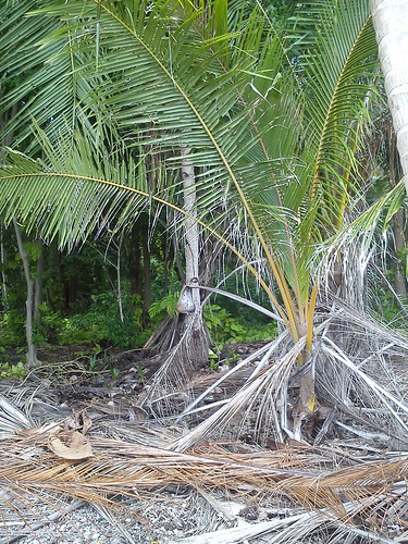
The interior of the island.
In the changed circumstances, the Expedition Team expedited our return to the ship and by about half past four, the ship was under way.
On to Ternate
Our next ‘Port of Call’, literally, was to be Ternate, in the Molucca Islands, 205 nautical miles from Pulau Boo. I’ll tell you more about our time in Ternate next time.
You can find all the posts on this trip here.
My pictures
The Boo Archipelago.
[Minor revisions, pictures and links added 24-Feb-2015 and 26-Feb-2015.]

.jpg)
